
Citymapper is a public transit app and mapping service which displays transport options, usually with live timing, between any two locations in a covered metro area. It integrates data for all urban modes of transport, including walking, cycling, ridesharing and driving, in addition to public transport.
Why use Citymapper?
Citymapper is free for both Android and iOs. Unlike Google and Apple Maps, which focus mainly on driving and walking trips, Citymapper encompasses everything. Citymapper has features that track trains, ferries, trams, and almost all kinds of public transportation listed in your city.
Coverage
Originally launched for London by an ex-Google employee, at the time of this writing Citymapper now covers 71 cities across UK & Europe, 27 in US & Canada, 2 in Latam and 7 in Asia-Pacific. You can check their up-to-date list of cities as well as vote for which you’d like to see covered here.
5 Reasons You’ll Love Citymapper
There’s nothing not to love about this app. We’ve already mentioned it’s free, but this is one app I’d happily pay a subscription to keep.
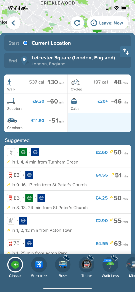
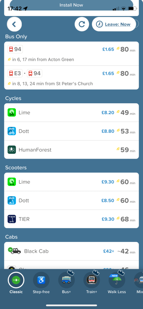
- It shows you a summary of all your options without making you tick into each one to check travel time and cost (or calories burned, in the case of walking/cycling). Note, in the case of rideshare, the cost is shown as “X amount+”, but I’ve found it to be accurate, certainly in terms of which companies are offering the better rates at the moment.
- It’s updated. So if your subway line is experiencing delays, that information will be included. If it’s not working at all, the option won’t be shown.
- When taking the tube in London requiring a transfer, it even shows you when you’re better off at the front, middle or back of the train, depending on the transfer point or exit. This saves time and snaking through a crowded platform.
- In one place you can see the relative costs of different public transport and rideshare providers for your desired trip.
- You can search for a given departure or arrival time on a given day. This is helpful ahead of deciding where to meet up with friends, whether to apply to a job across town, etc. Word to the wise: you’ll want to check again before travel closer to the time/day as things obviously can change.
How to Use Citymapper
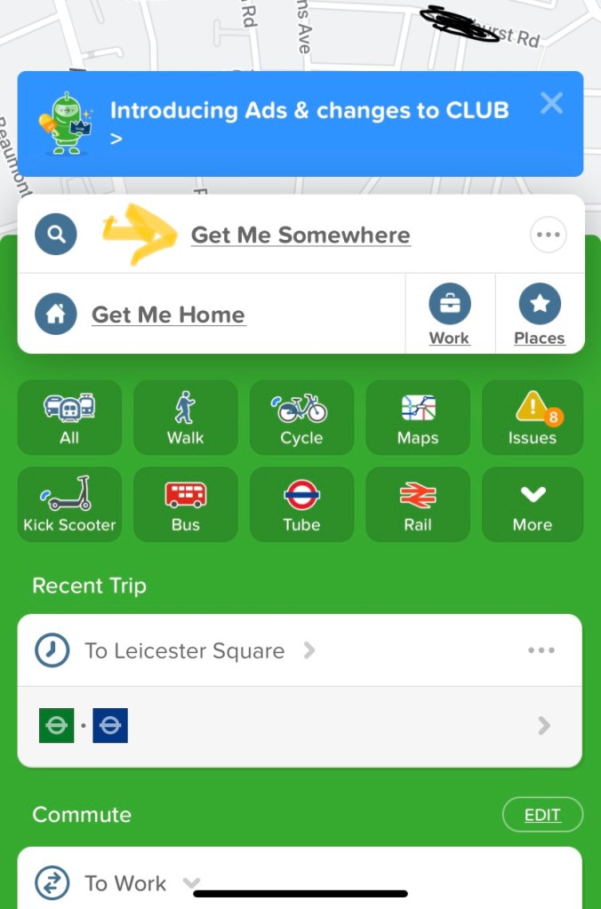
Download the app ![]() from the App Store or Google Play. Open it and you’ll see a screen like the below (London version shown). Tap “Get Me Somewhere”. This will bring up the keyboard option (as well as recent searches once you’ve used it).
from the App Store or Google Play. Open it and you’ll see a screen like the below (London version shown). Tap “Get Me Somewhere”. This will bring up the keyboard option (as well as recent searches once you’ve used it).
Start typing, and it will bring up likely matches you can then select once it shows the choice you’re looking for. You can input street addresses or places of interest (eg rail stations, restaurant names). If you simply put in a street without a numbered address, it will guide you to the middle of the street. In London, it also works with postcodes as these are specific to a small area (generally one city block of one road).
Once your desired destination comes up, scroll down to see all the options of how to get there.

If you want to know how to get from B to C (ie not from where you are now but where you’ll be at another time), simply tap the top text box that reads as default (Current Location), and this will bring up the keyboard where you can start typing your desired starting point.
Add your home address to save steps whenever you want to get home from wherever you are in your given city. Instead of “Get Me Somewhere”, you simply tap “Get Me Home”, and the app brings up all your options. Much appreciated when you’re tired and just want to be home sweet home without a lot of faff.
Top Tip
From experience, I know to look up my intended trip ahead of time and take screenshots of each leg of the journey. Why? Because phone coverage can be spotty especially using underground options, although poor connections can happen anywhere.
This way you’ll have a back-up if you’ve forgotten where you need to change or exit, for example. It also means you won’t need to stand near a busy entrance/exit waiting to get signal as you can simply tap the screenshot in your photos to see if you’re meant to turn left or right outside the station or alighting the bus. Just remember to delete these pics once done so you don’t clog up your memory.
After using Citymapper a few times, you’ll probably wonder how you’d gotten along without it for so long. And when you visit another of the cities covered, it is so much easier than trying to read a map or come to terms with an additional app.
If you’ve found this post useful and you’re not already subscribed, why not sign up today. It’s free, and we won’t share your details.
Let us know below if you’ve enjoyed this post (or not so much)…
